Build with Google
Google is setting the pace for innovation, providing the tools and technologies to help organisations build smarter, scale faster, and innovate with confidence. At NGIS, we help organisations leverage the world’s most trusted location data to build custom mapping solutions that scale.
From dynamic routing and asset tracking to visualising complex geospatial data, we help you bring location to life – whether you’re improving logistics, planning infrastructure, or creating seamless digital experiences.
Google Maps Platform
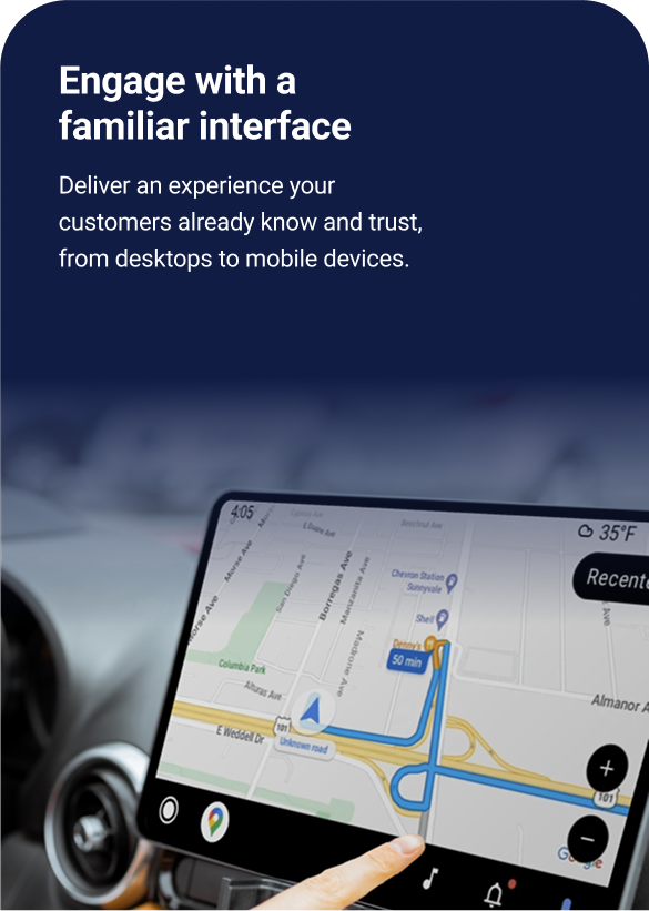
Build with confidence using Google Maps Platform, powered by industry-leading data that’s updated over 100 million times each day across more than 250 countries and territories. Deliver fast, scalable, and secure location-based experiences with the reliability of Google infrastructure. With a familiar interface your users already trust across all devices, and enterprise-ready AI backed by the power of Google Cloud, you can turn real-world insights into impactful digital solutions.
Google Maps Platform comprises 5 streams, Maps, Routes, Places, Environment and Analytics. Each offers powerful tools for maps, places, routes, environment, and mobility. NGIS can integrate static or dynamic maps into your website or application, delivering valuable location context to your users wherever they are
Integrate static or dynamic maps into your website or application, delivering valuable location context to your users wherever they are
Maps
Build customised, agile experiences that bring the real world to your users with Static and Dynamic maps, Street View imagery, and 360° views.
Routes
Help your users find the ideal way to get from A to Z with comprehensive data and real-time traffic.
Places
Help users discover the world with rich place data for over 200 million points of interest. Enable them to find specific places using phone numbers, addresses, and more.
Environment
Get the latest data on the environment in a given location. Then use this data for everything from keeping allergy sufferers healthy to designing optimized solar panel array designs.


Geospatial datasets & Cloud Analytics


Maps API
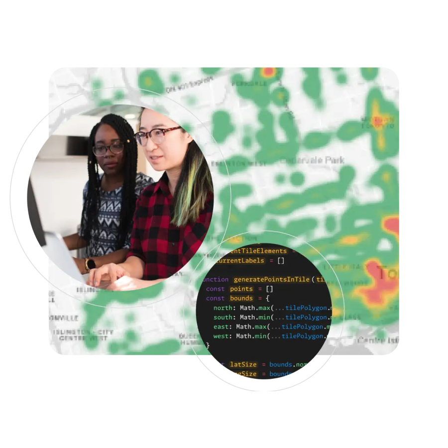
A multimodal model from Google DeepMind, is capable of understanding virtually any input, combining different types of information, and generating almost any output. Prompt and test Gemini in Vertex AI using text, images, video, or code.

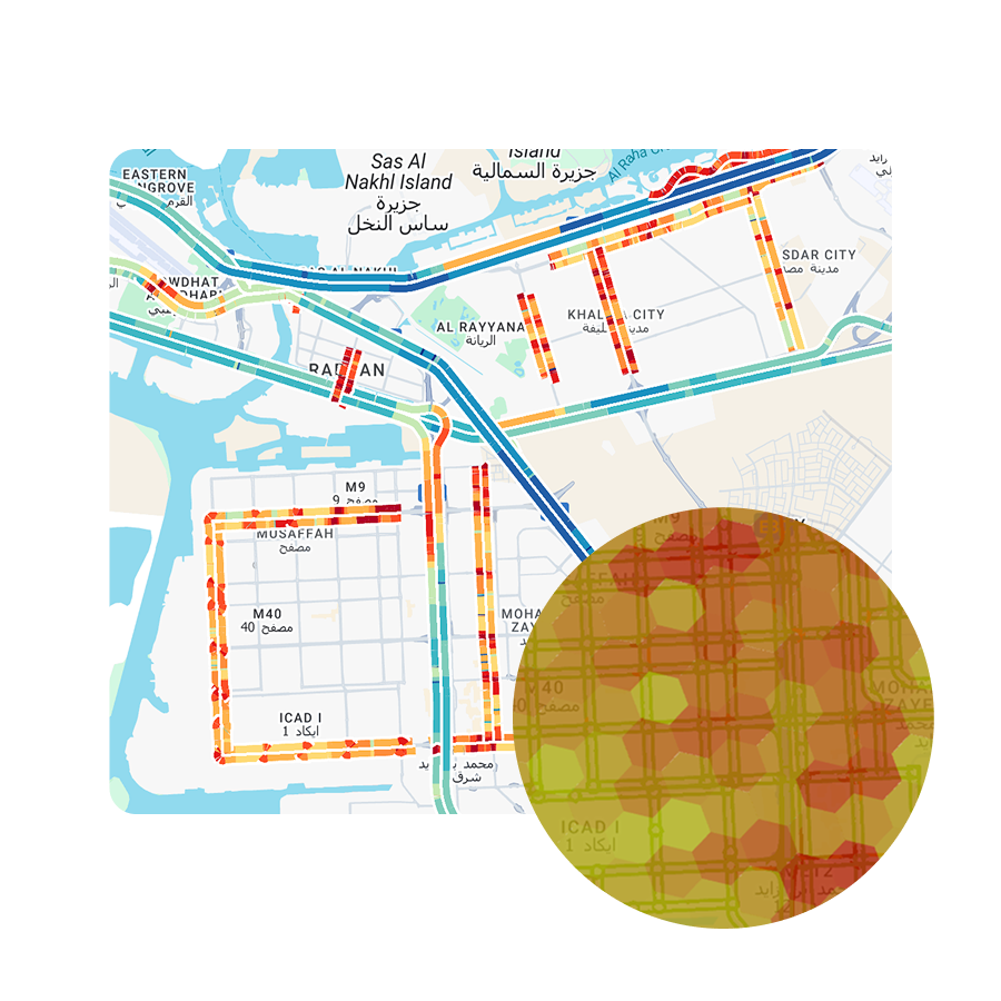
Road Management Insights
A single platform for data scientists and engineers to create, train, test, monitor, tune, and deploy ML and AI models. Choose from over 150 models in Vertex’s Model Garden, including Gemini and open source models like Stable Diffusion, BERT, T-5.

Places Insights
Power business decisions with place insights. Securely combine your geospatial data with Google Maps’ rich POI data using Places Insights in BigQuery’s data clean rooms.

Imagery Insights
Connect the physical and digital worlds. Transform your operational model, workflows, and decision making with large-scale remote sensing and AI-powered insights from Google Maps Platform imagery.


Innovate with Google AI
Google leads the world in AI innovation and it’s changing how we build, operate and grow. At NGIS, we help clients integrate Google’s AI capabilities into their projects to automate, predict, and solve.
Visualise your geospatial data with Google Maps Platform
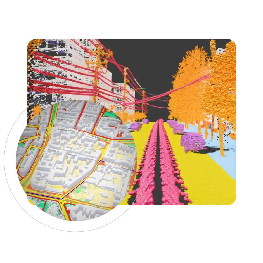
3D Maps
Photorealistic 3D Maps in Maps JavaScript using Google’s rendering technology.
Aerial View
Pre-rendered, 3D cinematic video of points of interest and surroundings. Allowing users to see the world from above.
Dynamic Maps
Style interactive maps using Cloud-based maps styling for real time updates across all devices and platforms.
Map Tiles
Interfaces and interactions unique to your organisation and design requirements and customise your visualisations.
Photorealistic 3D Tiles
3D mesh model of the real world using the renderer of your choice to create cinematic experiences.
Street View Tiles
Use images taken from street level and tile metadata to create powerful, immersive experiences.


Partner with NGIS
As a long-standing Google Premium Partner, NGIS has deep experience in delivering Google Maps solutions for public and private sector organisations across Australia and beyond.
Our unique strength lies in combining Google Maps Platform with advanced geospatial analytics, helping clients go beyond navigation toward spatial intelligence that transforms decision-making.

Why build with Google?


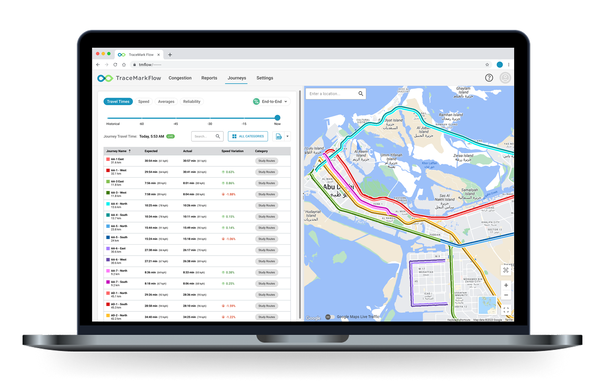
TraceMark Flow
TraceMark™ Flow powered by Google Maps Platform is a flexible software product that delivers city-wide traffic monitoring and actionable intelligence via a visualisation web dashboard and data access API. With increased livability and sustainability policy targets, TraceMark™ Flow enables cities to improve traffic flow and reduce the environmental, social, and economic impact of congestion by analysing accurate, timely, and relevant traffic information to improve performance and city sustainability.
TraceMark™ Flow features include:
- Travel Time data at scale
- Actionable congestion insights
- Integration with internal systems
- Improved sustainability outcomes